Offline Maps (Japan Only)
The offline maps feature saves GSI maps (Standard Map and Pale Map, provided by the Geospatial Information Authority of Japan) onto your device in advance. Because it works with GSI maps, offline maps can be created for areas within Japan only.
Why You Need Offline Maps
Normally, the app needs an internet connection to display maps. Every time you scroll the map, it has to fetch the images and data needed to display the map from servers on the internet. While hiking or cycling, however, you cannot count on always having a good signal and a reliable internet connection. In fact, in most mountain areas it is fair to say that places with an internet connection are the exception. By saving the map data for the areas you need into the app in advance, you can display the map without any problem even in environments with no internet connection. SkyWalking V2 lets you create such maps, and calls them "offline maps".
The Difference from Automatic Caching
Meanwhile, SkyWalking V2 automatically saves tile images that have been downloaded from the server and displayed on the map as a cache inside the app, so that they can be reused while offline.
The areas where offline maps can be created are limited to the areas covered by the "GSI Standard Map" and "GSI Pale Map" base maps (Japan only). For other areas, such as outside Japan, displaying the area you want to view offline on the map once saves it in the app as a cache, so you can use it as a substitute for offline maps. Note, however, that tile images for zoom levels you have never displayed are not cached. To use the automatic cache reliably as a substitute for offline maps, you need to display the map in advance — while you still have an internet connection — at the zoom levels you will want to see offline, so that it is cached automatically.
Note that neither downloaded offline maps nor the automatic cache are ever deleted automatically by the app. They are removed only when you delete them yourself.
Support by Map Type
Coverage areas and support for offline map creation and automatic caching, by map type:
| Map type | Coverage area | Offline map creation | Automatic cache |
|---|---|---|---|
| AppleMap | Worldwide | No | No |
| OpenStreetMap | Worldwide | No | Yes |
| GSI Standard Map | Japan only | Yes | Yes |
| GSI Pale Map | Japan only | Yes | Yes |
| GSI Aerial Photo | Japan only | No | Yes |
| Overlays | --- | No | Yes |
How to Create Offline Map Data
The steps for creating offline map data are:
- Set the base map to the GSI "Standard Map" or "Pale Map".
- Specify the area for the offline map data.
- Specify the map data name, scale, and destination folder.
When creating offline map data in SkyWalking V2, you select either the GSI "Standard Map" or "Pale Map". Since these maps cover only Japan, in the current version offline map data can be created only for areas within Japan. We would like to support areas outside Japan in the future, for example by using OpenStreetMap, but at present only GSI maps are supported. For areas outside Japan, display the area in advance on OpenStreetMap at the zoom levels you will need, so that it is automatically cached and can be used as a substitute for offline maps.
Before Your Trip: Creating an Offline Map — Download over Wi-Fi at Home
Downloading an offline map takes a fair amount of data. We recommend creating it by the day before your trip, in a stable network environment such as your home Wi-Fi.
1. Switch the Base Map to a GSI Map
Switch the base map to "GSI Standard" or "GSI Pale". For how to switch, see "Map Types and Switching".
2. Specify the Area
Tap the offline map creation button on the map screen to open the area selection screen. Drag the handles on the sides and corners of the green rectangle to set the area for your offline map, then tap "Next".
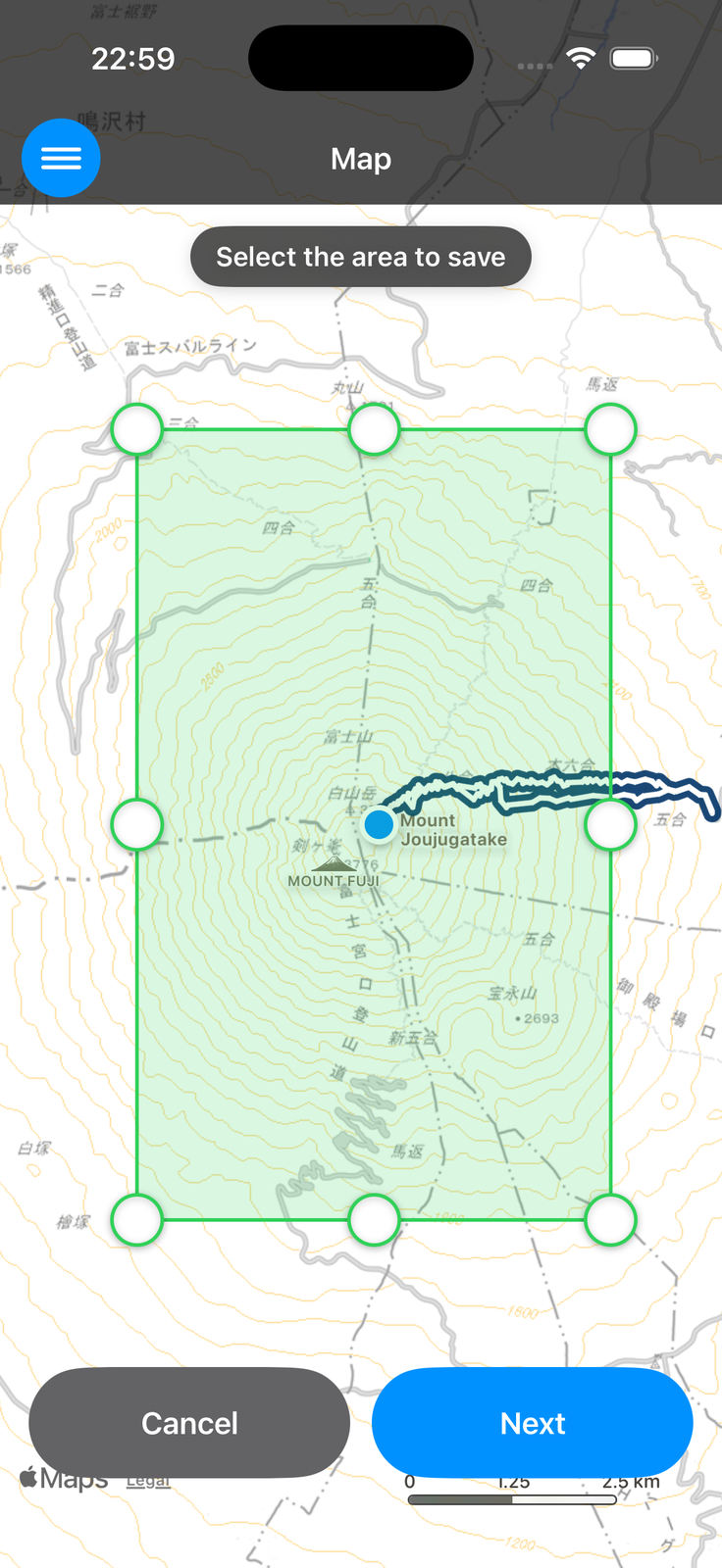
The number of tiles a single offline map can download is limited to a maximum of 6,000. If the area is too large, the map cannot be created on the next screen — narrow the area, or split it into multiple offline maps.
3. Specify the Name, Scale and Destination Folder
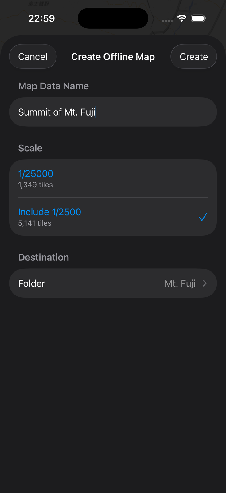
Specify the offline map's name, scale, and destination folder.
-
Scale: "1/25000" is the base, and you can also select "Include 1/2500" for more detail. The latter fetches tiles down to more detailed zoom levels, but increases the number of tiles to download. The tile count for each option is shown on screen — use it as a guide to the size. If the tile count exceeds the limit of 6,000, it is shown in red ("N tiles — exceeds the limit of 6000") and the map cannot be created. Go back to the area selection and narrow the area, or turn off "Include 1/2500".
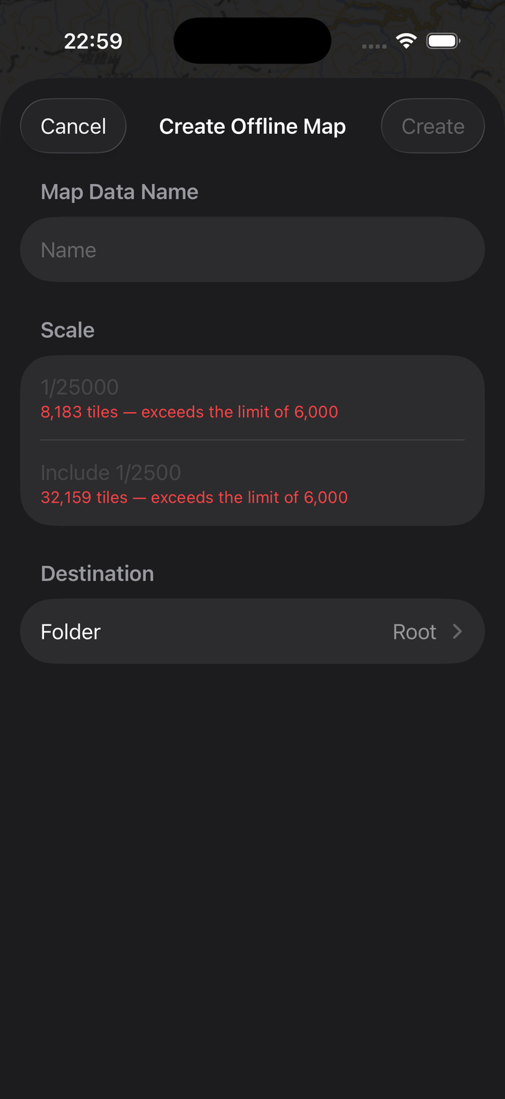
When the limit is exceeded -
Destination: you do not have to specify a folder (the map is created at the root). You can create a new folder at creation time, or move the map to another folder later.
4. Start the Download
Tap "Create" and a confirmation appears. Tap "Start" and the download begins. Do not quit the app until it finishes.
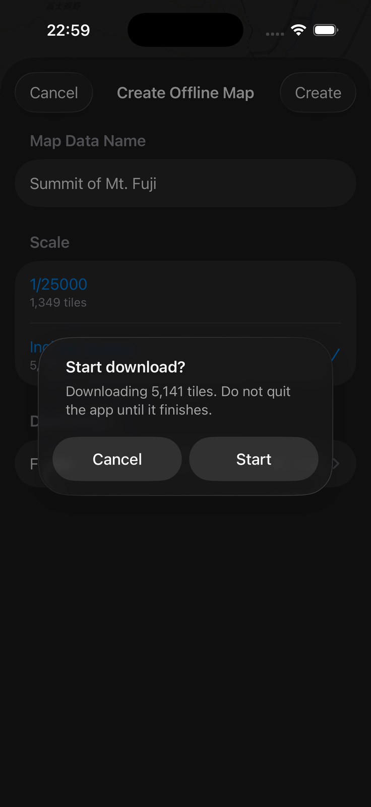
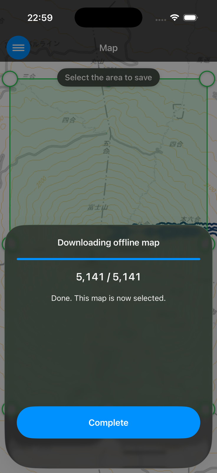
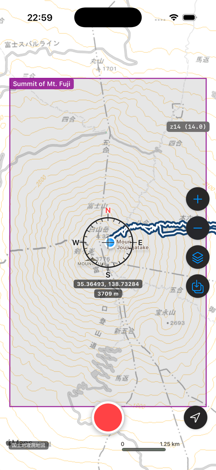
A map whose download has completed is automatically set to "Selected". You can start using it right away.
Managing Offline Maps — Selected, Frame Shown and Frame Hidden
Open the offline maps screen from the menu button to see the list of offline maps you have created.
An offline map is in one of the following three states. You can tell the state by the icon on the left of the list.
- Selected: the offline map is active. Even with no signal, the selected offline map is displayed. On the map, its area frame is shown as a purple rectangle. Only one offline map can be Selected at a time.
- Frame shown: the map is not active, but you can see which area it covers — the area frame is shown as a black rectangle on the map. Multiple offline maps can be set to Frame shown.
- Frame hidden: nothing is shown on the map.
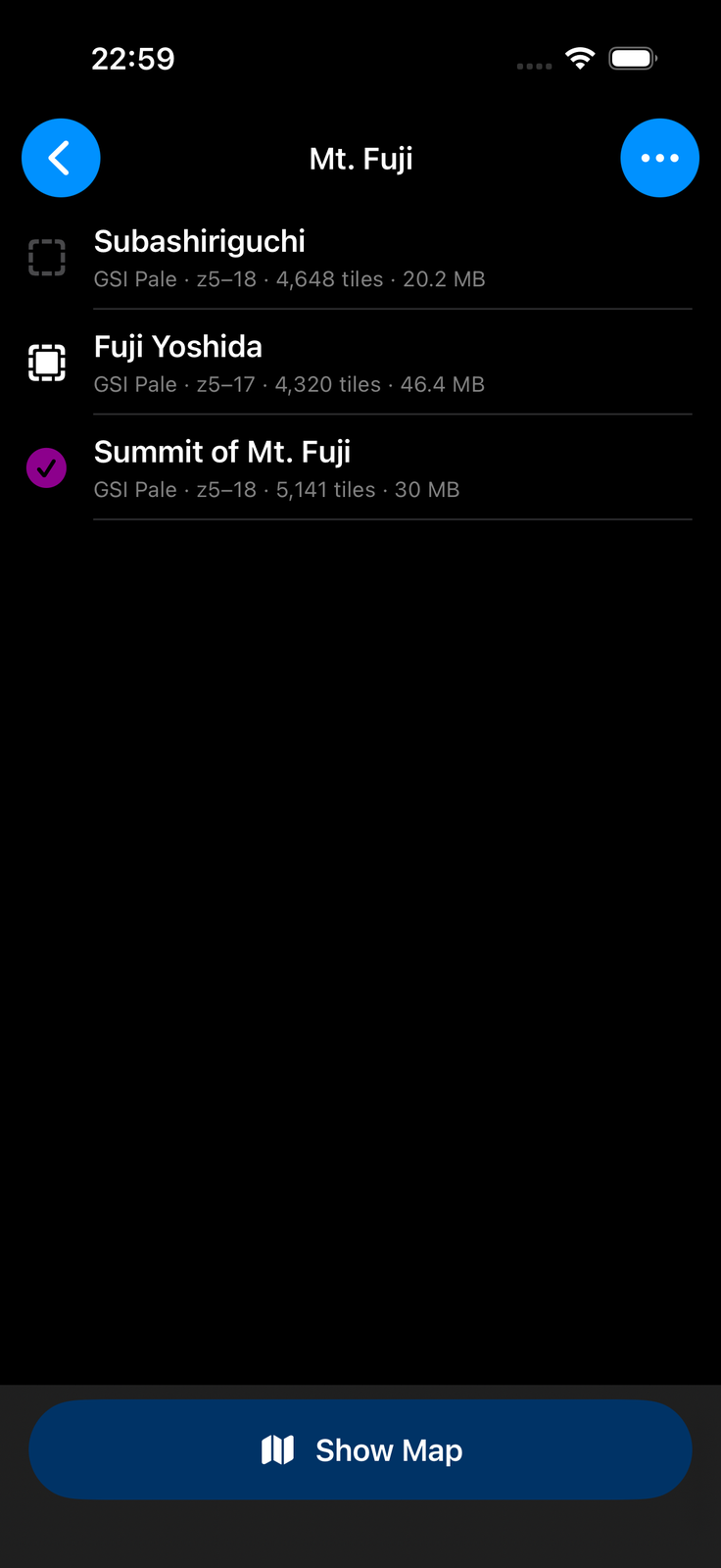
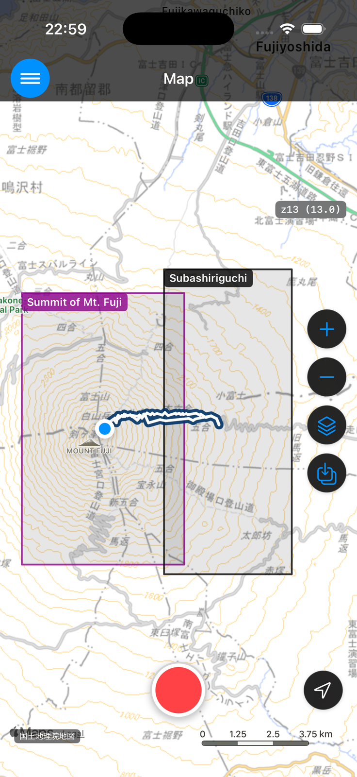
You can toggle between Frame shown and Frame hidden simply by tapping the icon on the left of the list.
To set an offline map to Selected, tap it in the list, then tap "Select". When you select it, the map moves to that area.
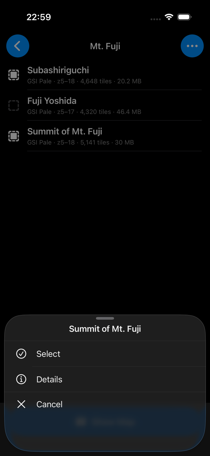
If you want to cover a wide area with offline maps, create several offline maps in advance, and switch between them in the field by changing the selection. Note that the free version can store up to 3 offline maps. If you need more, consider SkyWalking V2 Pro, which removes the storage limit.
Organizing Files (Delete, Move, Rename)
Tap the "..." button at the top right of the list to enter file management mode. You can delete offline maps, move them into folders, rename them, and create folders. To finish, tap the "✗" button at the top right to leave file management mode.
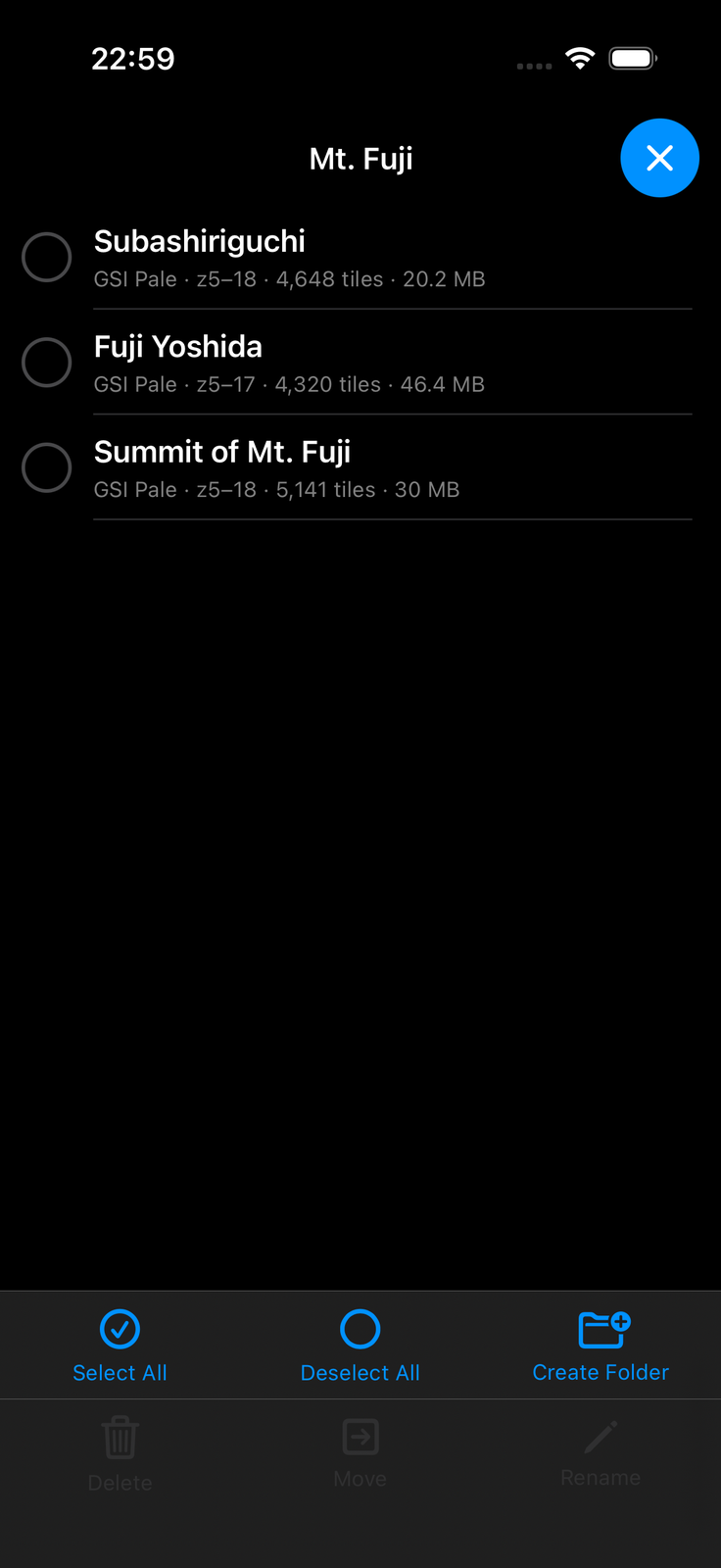
An offline map disappears only when you yourself delete it here. The app never deletes it automatically.
Things to Know
- The free version can store up to 3 offline maps. SkyWalking V2 Pro removes this limit. See "Free Version and SkyWalking V2 Pro" for details.
- Offline maps can be created only from the GSI Standard Map and Pale Map (the GSI Aerial Photo, although also a GSI map, is not eligible). OpenStreetMap supports automatic caching, but does not support offline map creation (bulk download).
- Offline maps use GSI map tiles. The content and availability of the map data depend on GSI.
If anything is unclear, please ask us via the contact form.
← Back to the User Guide contents