Recording and Saving GPS Logs
GPS logging is the core feature of SkyWalking V2. It records your track and saves it as a GPX file in the app. This page explains the flow from starting a recording to saving it, and the design that prevents you from losing a recorded track.
Before You Start — Location Settings
Recording a GPS log requires permission to use location services. The first time you start a recording, a permission dialog appears — please allow it.
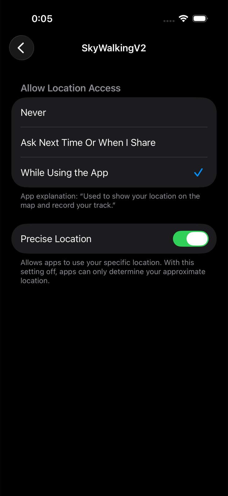
In the iOS Settings app, go to "Apps" → "SkyWalkingV2" → "Location", and we recommend the following settings:
- Allow Location Access: "While Using the App"
- "Precise Location": On — an accurate track cannot be recorded while this is off.
Starting a Recording
Tap the GPS recording start button at the bottom of the map screen to start recording. While recording, the button in the same spot changes to the GPS recording stop button.
GPS recording start button — tap to start recording.

GPS recording stop button — shown while recording; tap to stop.
When recording starts, the screen changes as follows:
- Distance, elapsed time, and elevation are shown in real time below the navigation bar.
- Your track is drawn on the map as a green line.
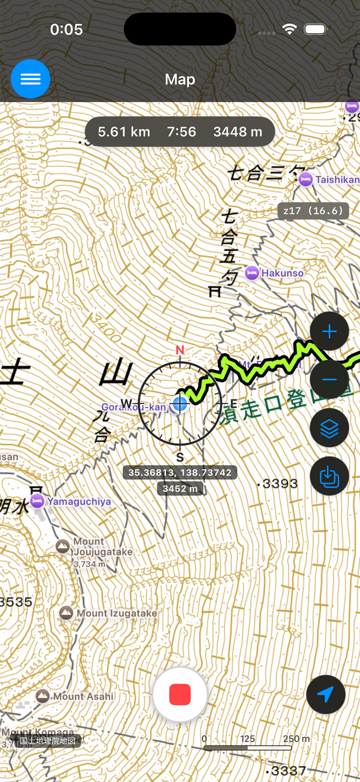
When follow mode is ON, the map moves automatically as you move, keeping your current location at the center of the center compass.
While Recording
Recording continues in the background even if you close the app or put your iPhone to sleep (screen off). You can keep the phone in your pocket with the screen off while recording.
Continuous GPS use drains the battery. For long hikes, we recommend recording with the screen off and carrying a mobile battery.
There is no pause function. To finish recording, use the stop procedure below.
Stopping and Saving
Tap the GPS recording stop button. A confirmation "Stop GPS logging?" appears. Tap "OK" to finish recording, and the "Destination / Name" screen appears.
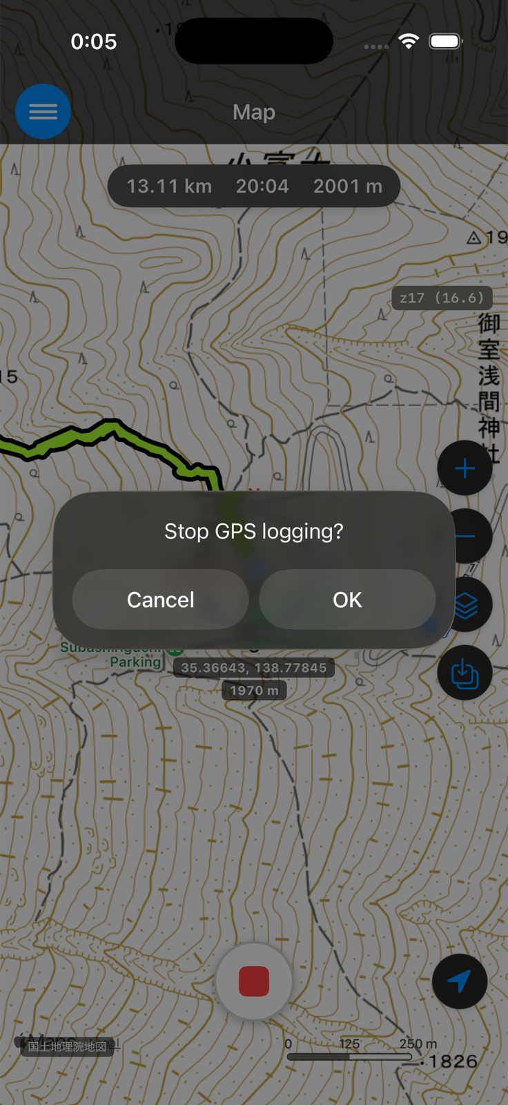
At this point, your track has already been saved in the "GPX" folder under its initial name (the recording start time). The "Destination / Name" screen only lets you change the name and destination — even if you close it with the × button without tapping "Save", your track is not lost. The app is designed so that you can never lose a track by forgetting to save it.
- Name — change it to something recognizable later, such as the name of the mountain.
- Destination — tap to open the folder picker. Navigate to the folder you want and tap "Save Here". You can also create a new folder with "New Folder".
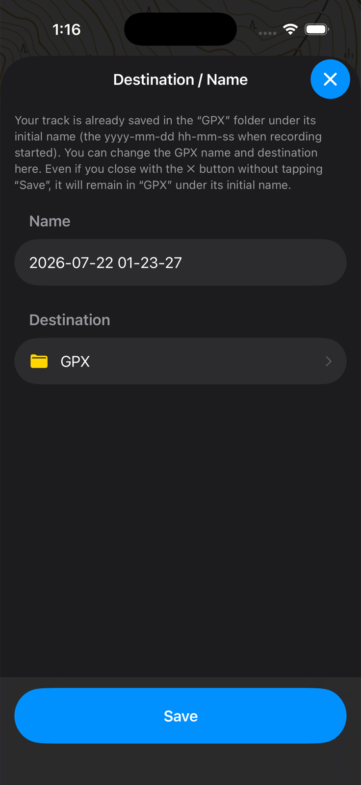
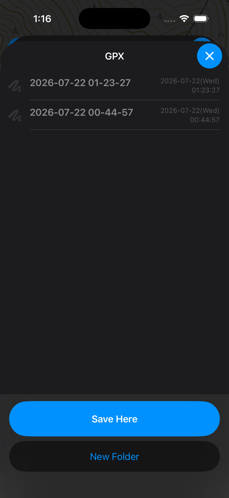
Finally, tap "Save" to finish.
Elevation Graph — Long-Press a Track
Long-press (about 2 seconds) a track shown on the map to display its elevation graph at the bottom of the screen. This works both for the track being recorded and for saved GPX files. For a recording track, the graph covers your progress so far.
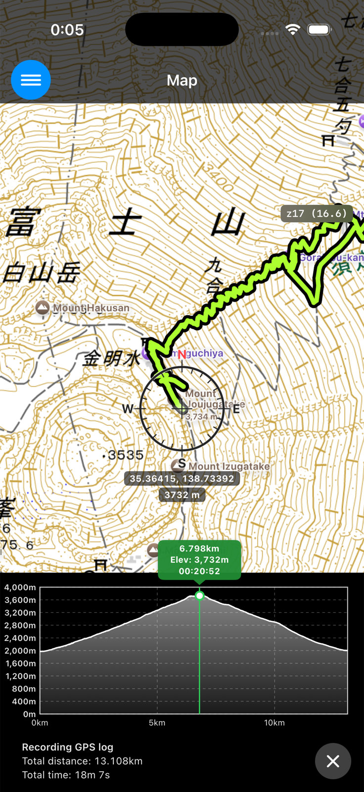
Touch the graph to see the location and elevation of that point on the map. Tap ✗ to close the graph.
How to display saved GPX files on the map, and how to organize them (moving between folders, renaming, exporting), will be covered on a separate page (coming soon).
Things to Know
- The free version can store up to 4 GPX files. SkyWalking V2 Pro removes this limit. Even when you reach the limit, saved tracks are never deleted. See "Free Version and SkyWalking V2 Pro" for details.
- The app never deletes your saved GPX files automatically. They are deleted only when you delete them yourself.
- Recorded locations, elevations, and distances are estimates based on GPS and other positioning technologies, and are subject to error.
If anything is unclear, please ask us via the contact form.
← Back to the User Guide contents